The first generation of controlled drones appeared during the First World War. The loudest American project, the Kettering Bug , was able to drop its wings on command from the ground and hit a target with itself – a sort of ancestor of a cruise missile and a kamikaze drone.
Now unmanned aircraft are much smarter and more functional. They not only perform complex military tasks, but also help increase crops and assess the damage from missile strikes – like, for example, the Ukrainian SKIF drone.
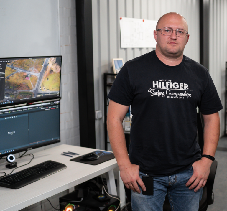
In a partner article with Culver Aviation , Andrey Levchuk, head of the company’s geographic information systems department, talks about the capabilities of modern drones.
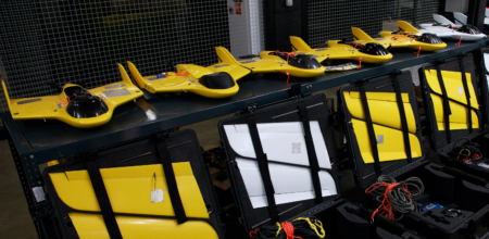
The predecessor of our SKIF was a reconnaissance aircraft , which was developed in 2014. He had a video camera and a thermal imager. This equipment was enough to find enemy units at any time of the day. Nothing more was asked of this drone.
In 2016, the military aircraft was upgraded for civilian tasks – this is how the SKIF model appeared. The video camera and thermal imager were replaced by a powerful camera with a 61-megapixel sensor and a full-frame 35mm matrix.
With the new “eyes” the aircraft can capture the Earth’s surface with a resolution of up to 1 cm per pixel. This is enough to see cracks in the asphalt from a height of 100 meters or to distinguish the structure of plants.
SKIF is now part of Culver Aviation’s geographic information system. This is a complex for collecting, storing and analyzing data on the state of the earth’s surface and objects on it.
More information about Culver Aviation here .
There is more information in the pictures SKIF takes than can be seen at a glance. Analytical tools and a bit of experience allow you to get a lot of value out of an ordinary clear photo. Here are some cases.
Measure field area and find problem areas
Imagine that you have a piece of land with an area of several thousand hectares and you want to get an image of it. That is, a huge photograph of the highest quality, in which any object is visible with reference to a given coordinate system.
This is the so-called orthophotomap. With the help of special software, it is stitched together from photographs taken by the drone during the flight. With orthomosaic, you can calculate the exact area of the site, the surface area of zones with elevation changes, and so on.
Orthophotoplan is a basic service for farmers. On it, we can determine the clear boundaries of the zones allocated for crops. And during the ripening of the crop, we see problems on the field: sifting, places where seedlings did not sprout, wet or trampled areas.
The agronomist still has to go to the field himself, but a preliminary analysis of the orthophotomap makes the check not chaotic, but orderly.
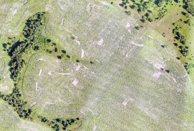
Here is an example. The photo above was taken with SKIF. It shows areas where the culture has suffered due to the influence of various factors. This is impossible to see if you examine only the edges of the field, and satellite photographs will not give such detail and relevance.
Also, high-resolution images are used to check various objects – from the quality of the ground cover to the condition of roads, pipelines and any extended objects.
You can learn more about the capabilities of the SKIF drone here .
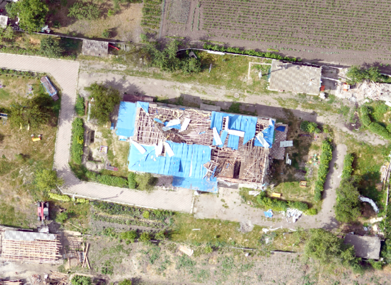
Create a 3D model for a construction project
Any photo taken by “Skif” can be digitized and get a digital terrain model 
 CMM . The outer surfaces of objects in such a model consist of clouds of a huge number of points in a three-dimensional coordinate system.
DSM is the easiest and most reliable way to get terrain information. Not a single BIM project Building Information Modeling – modeling of building objects is not implemented without highly accurate information about the local landscape.
If orthomosaics are used by farmers and cartographers, then point cloud analytics are more attracted to building and utility designers.
For example, when designing a residential complex, you can calculate the optimal installation locations for surveillance cameras. Or see where rainwater will accumulate, and plan a square with moisture-loving plants in this place.
With the help of DTM, it is possible to calculate the number of ground objects with an accuracy of up to 90% – materials at a construction site or rocks in a quarry.
You can learn more about the capabilities of the SKIF drone here .
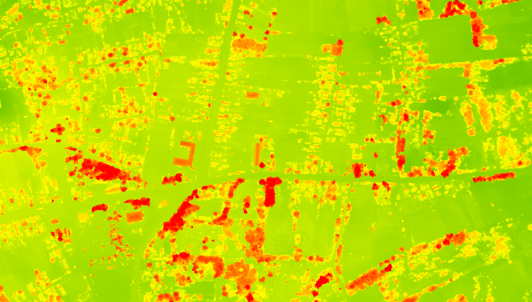
Early detection of crop diseases
Multispectral photography, that is, shooting in certain ranges of the electromagnetic spectrum, is used in the restoration of ancient manuscripts, the detection of fakes, and weather forecasting.
The main advantage of such shooting is that it allows you to see the nuances that are inaccessible to human vision.
Multispectral imaging helps farmers:
- determine the degree of vegetation of plants;
- determine the content of chlorophyll in plants;
- make a yield forecast;
- identify the source of the problem in the early stages and promptly solve it.
For shooting in multispectrum, detail is also important. Plant diseases begin with small foci that can only be seen on clear photographs taken and processed on time. In large areas, only unmanned aircraft of the SKIF type, complete with the work of GIS specialists, will cope with such a task.
Assess the consequences of destruction
New methods for analyzing images from UAVs involve artificial intelligence and machine learning. Together with information about the location of objects, these technologies have been used for several years to calculate the damage from earthquakes, hurricanes, tsunamis, tornadoes and fires.
With the help of “Scythians” you can assess the consequences of floods and other natural disasters such as forest fires and hurricanes. In Ukraine, destruction from rocket and artillery attacks has been added to the list of troubles. Information about them can be used to calculate material damage and compensation from the aggressor.
To create a system capable of doing analytics of this level, you need a neural network and a data array. Moreover, the more data, the better the machine will learn to distinguish between damage and classify them.
With the help of this system, GIS specialists analyze the visual information from the drone and issue it in the form of a report.
A recent example is that Culver Aviation specialists flew around one of the villages in the Chernihiv region, which suffered as a result of Russian occupation, and identified damaged buildings.
You can learn more about the capabilities of the SKIF drone here .
Order a service or explore on your own?
An orthophotomap can also be made using a copter, but the latter are only suitable for monitoring small areas. In one day, the copter can fly several hundred hectares, depending on the model and the number of batteries. At such a speed, the customer will not be able to quickly get the necessary analytics.
But aircraft-type UAVs can easily cope with voluminous tasks. For one battery charge SKIF flies up to 1.5 thousand hectares. If an enterprise needs to quickly remove tens of thousands of hectares, a larger fleet can be attracted. Culver Aviation , for example, has one of the largest fleets of aircraft in Ukraine specifically for such cases.
How quickly the customer receives an analytical report depends not only on the capabilities of the drone, but also on the level of computing power. For example, according to the average data of the Skif flight on one battery, an orthophoto map made with a resolution of 1 cm per pixel can weigh up to 70 GB.
To work with large agricultural holdings or energy providers, “home” capacities will not be enough. The same applies to skills for preparing analytical reports. That is why our company changed its business model several years ago from selling drones to providing Drone-as-a-Service. With such a system, the customer does not spend money on maintaining a fleet of aircraft, specialists who collect and analyze information, and excess server capacity.
The range of services provided by drones is growing: aerial photographs combined with modern technologies cover business needs and help save time, human resources and, finally, money.


