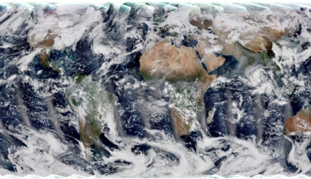
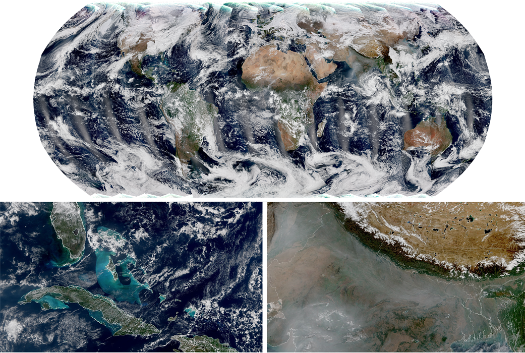
NOAA-21 sent back the first images obtained by the VIIRS instrument, showing stunning views of the turquoise waters of the Caribbean Sea, the snow-capped Himalayas and smog clouds over northern India.
One month ago, on November 10, 2022, NASA launched the NOAA-21 satellite from Vandenberg Space Force Base in California. The Visible Infrared Imaging Radiometer Suite (VIIRS) instrument on NOAA-21 began collecting ground data on Dec. 5 as the satellite passed over the US East Coast. Information for the global image was recorded during the day between December 5 and 6.
The VIIRS instrument provides global measurements of the atmosphere, land and oceans, and provides information that scientists can use in fields ranging from crop forecasting to analyzing the spread of wildfire smoke. Above the oceans, the device measures the temperature of the water surface (an indicator important for monitoring the formation of hurricanes), and also records its color (helps scientists monitor the activity of phytoplankton).
“The turquoise color seen around Cuba and the Bahamas in the image is caused by precipitation in shallow waters around the continental shelf,” said Dr. Satya Kalluri of NOAA (National Oceanic and Atmospheric Administration).
Above ground, VIIRS can detect and measure wildfires, droughts, and floods, and its data can be used to track the density and movement of wildfire smoke. The lower right image above shows haze and soot over northern India, likely caused by crop burning. The snow-capped Himalayas and the Tibetan Plateau can also be seen in the north.
Course
WOMEN IN LEADERSHIP
Learn how to maintain work-life balance from a top executive with experience at NPR, Microsoft, IBM, and Amazon Alexa.
REGISTER!
One of the unique features of VIIRS is its day-night range, the device can capture nighttime images of city lights, lightning, auroras, ship lights and fires. The instrument also generates critical environmental data on snow and ice cover, clouds, fog, aerosols and dust, as well as crop conditions.
“We’re launching multiple weather satellites to have a better chance of one of them continuing to operate. Space is a dangerous environment. “Instruments or satellites are lost, but the data they receive is too important for us to lose,” says Dr. Gleeson.
NASA and NOAA jointly oversee the development, launch, testing and operation of all satellites under the Joint Polar Satellite System program. NOAA funds and manages the mission, operations and data. NASA and commercial partners design and build instruments, spacecraft and ground systems, and launch satellites.
Two weeks ago, NOAA-21’s ATMS (Advanced Technology Microwave Sounder) instrument received its first global image.
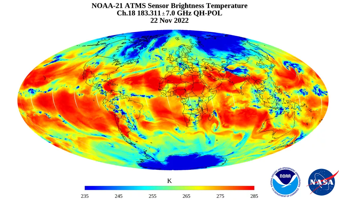
The device gives weather forecasters a global three-dimensional picture of our atmosphere’s temperature and humidity — fundamental information needed by models who forecast the weather every day and warn of hurricanes, floods, droughts, abnormal heat, blizzards and other weather events. Because ATMS observes the Earth in the microwave range of the electromagnetic spectrum, it can see through clouds like an X-ray into the structure of the atmosphere and can peer inside storms.