The morning of August 18 began with unusual news for Ukrainians, which read: “The Prytula Foundation bought a satellite.” Behind such a high-profile name there are several factors, including image ones – after the failure with the Sich-2 satellite, official Kyiv can boast of its own aircraft in Earth orbit. However, can Prytula’s “satellite” really be able to help change the situation at the front, at least in certain areas, and how commercially profitable is the project?
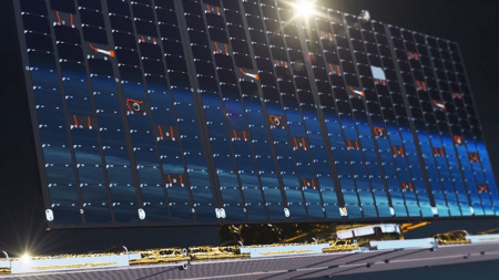
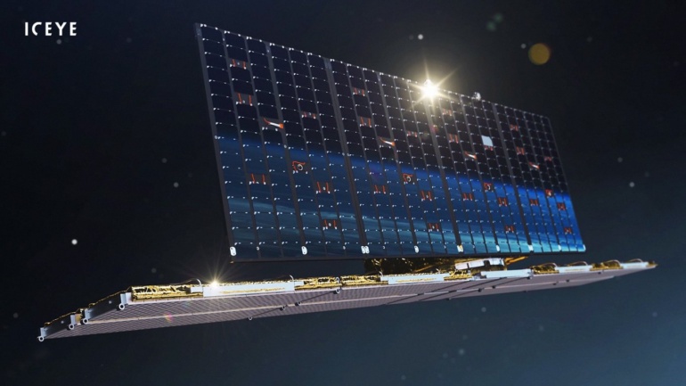
It all started with an agreement between the foundation of the famous Ukrainian volunteer Serhiy Prytula and the Finnish company ICEYE, which owns a network of so-called radar satellites. These sizings use the technology of “illuminating” objects on the surface of the Earth using radio waves. Finnish ICEYE is one of the largest satellite aircraft in the sector. According to unofficial data, it operates about 20 radar satellites, in English referred to as SAR satellites. For comparison, the American space company Capella Space, one of the first to start using SAR satellites, has 8 vehicles in orbit.
The essence of the agreement is as follows – the Ukrainian side receives one of the ICEYE satellites for full use. It is not yet very clear how this looks legally – whether it is a purchase, or an indefinite lease. In addition, there is no amount that cost the Ukrainian side. It can be assumed that all the money collected for the purchase of Turkish Bayraktar drones in the amount of UAH 600 million went to this agreement. Nevertheless, there are other interesting details – the contract also provides for a one-year “subscription service”. The fact is that the SAR satellite can take two pictures of Ukrainian territory per day. Such a moment is explained simply – the satellites are at an altitude of 560-580 km above the Earth’s surface, fly in a sun-synchronous orbit and “see” a given point only a limited number. Therefore, the Finns offered another option – the rest of their devices, flying over Ukraine, can also supply images to Kyiv.
Pavel Potseluev, head of the Alpha Centauri project, which popularizes space exploration, says that even 2 photos per day, which will be provided by “our” satellite, is very good. This data is received directly by Ukrainian intelligence. Potseluev believes that other satellites will also provide additional data and estimates the number of successful images as 4-6 per day (one image for 6-4 hours), because not all of the Finnish company’s devices have a successful orbit tilt to observe the Ukrainian territory.
In order to understand how many or how few images it is, you need to talk about the technology of radar satellites and how they work.
“Microwave” in space
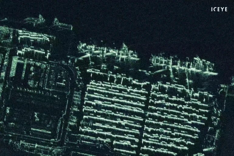
In contrast to the usual use of optical instruments in Earth orbit, radar imaging is a completely different principle of aerospace “image capture”. This technology is based on a radar with an active microwave sensor. It is he who is able to emit and receive polarized radio waves reflected from the earth’s surface, and in a certain wavelength range. This is how the radar satellite system works – by constructing maps of the earth’s surface – waves are reflected from buildings, structures, road infrastructure, various equipment, including military equipment. Kisses points to another important characteristic among the additional advantages of this technology – electronic warfare equipment and radar stations “shine” in the images, that is, they are very noticeable. This factor is important in the light of the anti-battery struggle at the front.
As a result, everything that can reflect a signal from space ends up in the visibility zone of the radar satellite. There is a small caveat here – SAR cannot detect people due to the above principle – the human body does not reflect radio waves.
There are a number of radar satellite technologies. The first is the so-called permanent scatterer interferometry (PS), which is used to detect the displacement of objects at certain distances, for example, when the location of the same military equipment changes. The second technology is small baseline interferometry (SBAS), which captures displacement in very precise parameters of less than 1 meter. So there are cases when, thanks to this technology, the deformation of the bridge was detected, in particular in Italy. Thus, it is possible to provide for the destruction of any important structure.
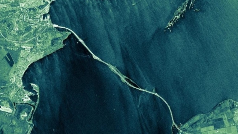
In general, radars can “see” almost any object on the surface of the earth – a tank, an armored car, wagons on a railway track. Moreover, it is metal objects that shine especially brightly. The detail of the image depends on the scanning scale: if we take an area of 100 km, then one pixel of the image will cover 15 km, which means that you can see the road, but not distinguish what is on it. If you scan an area of 30 meters, then you can recognize the exact location of equipment, say air defense. An important point is that for such a satellite there are no barriers in the form of rain, fog or clouds, which is an indisputable advantage over optical systems.
Radar satellites perform multiple surveys of a territory ranging in size from 15×15 km, and as a result, they receive a file with radar signal shift points. In fact, a RAW – “raw” image is a continuous photographic noise that still needs to be interpreted – that is, to pass the file through certain filters and programs, ultimately obtaining the image that users are used to seeing from conventional cameras.
This is one of the most important points. So experts believe that ICEYE itself should do the pre-processing, and the Ukrainian GUR (Main Intelligence Directorate) will further analyze and interpret the images. Such a process may take some time, so shooting and interpretation will not take place, which is called “from the stream”. That is why it will be important to establish processing, optimize it and systematize it.
Prospects after the war
It is now clear that the ICEYE satellite covers several issues at once. First of all – operational reconnaissance on the battlefield. It is not known how often Western countries transfer intelligence from satellites to the Ukrainian army. It can be assumed that there is coordination between the Armed Forces of Ukraine and the Pentagon in terms of requests for information from certain participants in the front line. But, such coordination can also take time, and having your own satellite can significantly speed up or supplement the process of satellite reconnaissance.
The second factor is the same unsuccessful case from the Sich-2 satellites, which, even if it is possible to “bring to life”, has a low image resolution unsuitable for the Armed Forces. This means that the ICEYE radar satellite can also be used for its intended purpose after hostilities – obtaining images from the Earth’s surface. So are known examples of commercial orders for SAR in agriculture to assess the future harvest or monitor potentially dangerous areas for soil displacement, floods and others.
Judging by the site imagery.geocento.com, the price per square kilometer from the GEOSAT-1 optical satellite will cost $ 0.08 per square kilometer. That is, for example, a picture of 840 square meters. km. will cost $171 with additional handling fees. However, companies like ICEYE offer a wider range of services, selling data packages ranging from the oil industry to images for insurance claims calculations. So the Finns in 2020, according to CNBC, signed contracts for their services in the amount of more than $ 50 million. In total, the satellite data market is estimated at $ 60 billion.
“I’m not sure that we have the right to resell data from other satellites, but after legal registration with the data of“ our ”bought device, in theory, we should do anything. Of course, it all depends on the contract, ”concludes Kisses.