Researchers at the University of California, San Diego have found a way to enable more precise indoor navigation for robots. A new system will help in this, using existing access points to determine their location with wheeled or walking vehicles. The results of the study are presented this week at the 2022 International Conference on Robotics and Automation (ICRA) in Philadelphia.
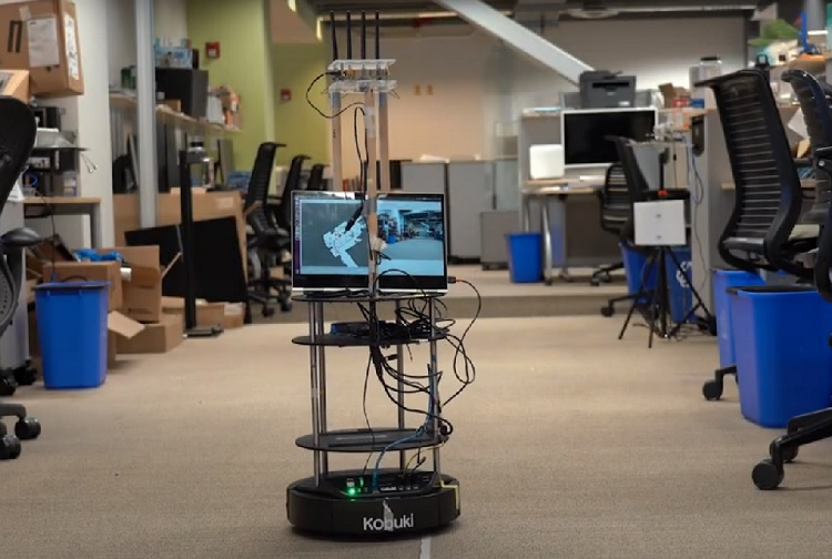
Image Source: UC San Diego
Although there is usually no or weak GPS signal indoors, robots can still navigate in space using conventional cameras and / or lidars. At the same time, failures are inevitable – for example, different corridors may look almost identical, and if a person orients himself by additional signs and signs, then robots are still deprived of such opportunities. In addition, lidars are quite expensive and consume a lot of power, and cameras can be interfered with by darkness or other low visibility conditions, such as pollution or smoke.
Considering that Wi-Fi access points are available in almost any premises, scientists have developed a system that will help robots navigate in space with a constant exchange of signals. Receiving a return signal from the access point at a certain angle from a certain distance allows you to accurately mark the location. The on-board computer evaluates information from all available data points, allowing the car to move without errors. At the same time, the camera can still and should be used, but mainly for avoiding obstacles and / or recognizing objects and people.
The system was tested on the same floor of an office building, in different lighting conditions. It turned out that when determining the location and mapping, the new robot was not inferior to models equipped with lidars. At the same time, the use of Wi-Fi is actually free.
If you notice an error, select it with the mouse and press CTRL + ENTER.